
Ruse
Bulgaria
Welcome to City Lab Ruse: Bridging Heritage and Resilience
Ruse, known as “Little Vienna,” is not only the largest river port in Bulgaria but also a crossroads of complex hydrological and ecological systems. As a city defined by the majestic Danube, our identity is deeply intertwined with the water that surrounds us.
Our City Lab focuses on the Rusenski Lom river basin – the last right tributary of the Danube before it flows into the Black Sea. This unique area serves as the primary testing ground for our efforts within the NBSINFRA project.
Through the Ruse City Lab, we are not just protecting a city; we are creating a scalable innovation package for the entire Lower Danube region, ensuring that our “Little Vienna” remains a safe and vibrant home for generations to come.
Sections

Historical background
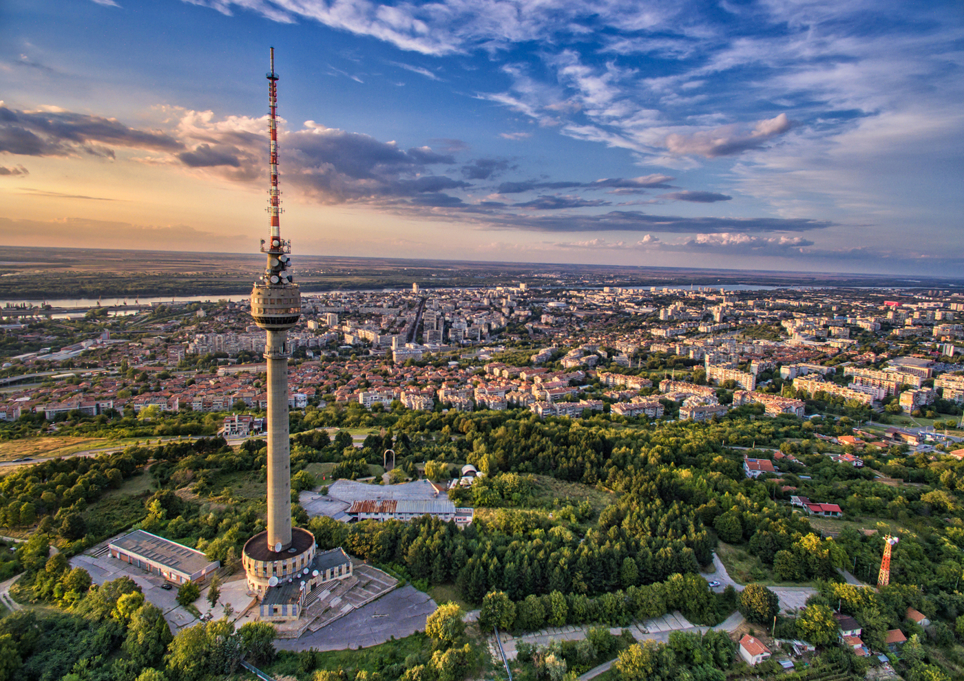
Ruse is a crossroads and cosmopolitan city. Throughout its 20-century history, different eras have left their mark on the diversity of cultural layers. However, its spirit remains unchanged – free and eternal like the great European river that generates influences, connects, inspires life, and promises a future…
Ruse is the largest Bulgarian city on the Danube River and the most important transport, logistics, economic, and cultural center for Northern Bulgaria. The city is located 300 km from Sofia and 70 km from Bucharest. The population exceeds 150,000 inhabitants.
Context and History: Rusenski Lom
The area is a unique microcosm where nature and human civilization have coexisted for millennia. It is a natural corridor connecting the Danube Plain with the Balkan Mountains and is home to an extraordinary heritage that NBS measures will help preserve.
- Canyon Rusenski Lom: The canyon is home to priceless historical monuments that are an integral part of our region’s identity. This is a protected site with an impressive canyon, up to 120 meters deep, inhabited by rare plant and animal species. Rusenski Lom Nature Park
- Rock-Hewn Churches of Ivanovo (UNESCO): World Heritage with unique frescoes from the 14th century. This medieval complex, carved into the rocks, is extremely sensitive to erosion and moisture. Nature-based solutions here focus on controlling the erosion of rock massifs and managing surface water above the site. Rock-Hewn Churches
- St. Dimitur Basarbovski Rock Monastery: The only active rock monastery in Bulgaria. Located directly next to the riverbed, it is highly vulnerable to flash floods, necessitating precise monitoring through our sensors. Rock Monastery
- Cherven Medieval Town: One of the most important military and cultural capitals of the Second Bulgarian Kingdom. Cherven fortress
Challenges: Flood Risks
The Rusenski Lom River is known for its unpredictable character and “flash” floods. Due to its snow-rain feeding, it frequently overflows its banks.
- Hydrological Risk: Sudden rises in water levels threaten both residential areas in lower parts of the city and infrastructure.
- Threat to Heritage: Floods and groundwater damage archaeological layers and compromise the stability of the rock massifs where historical sites are carved.
- Erosion: Past deforestation of riparian vegetation has increased surface runoff speed.
- Risk to People: Floods often compromise drinking water wells (e.g., in the village of Bozhichen), leaving the population without potable water.
Monitoring and Technology
Unlike traditional dikes, Ruse is implementing “smart” infrastructure that allows nature and technology to work together. ACWA Early Warning System: ACWA System
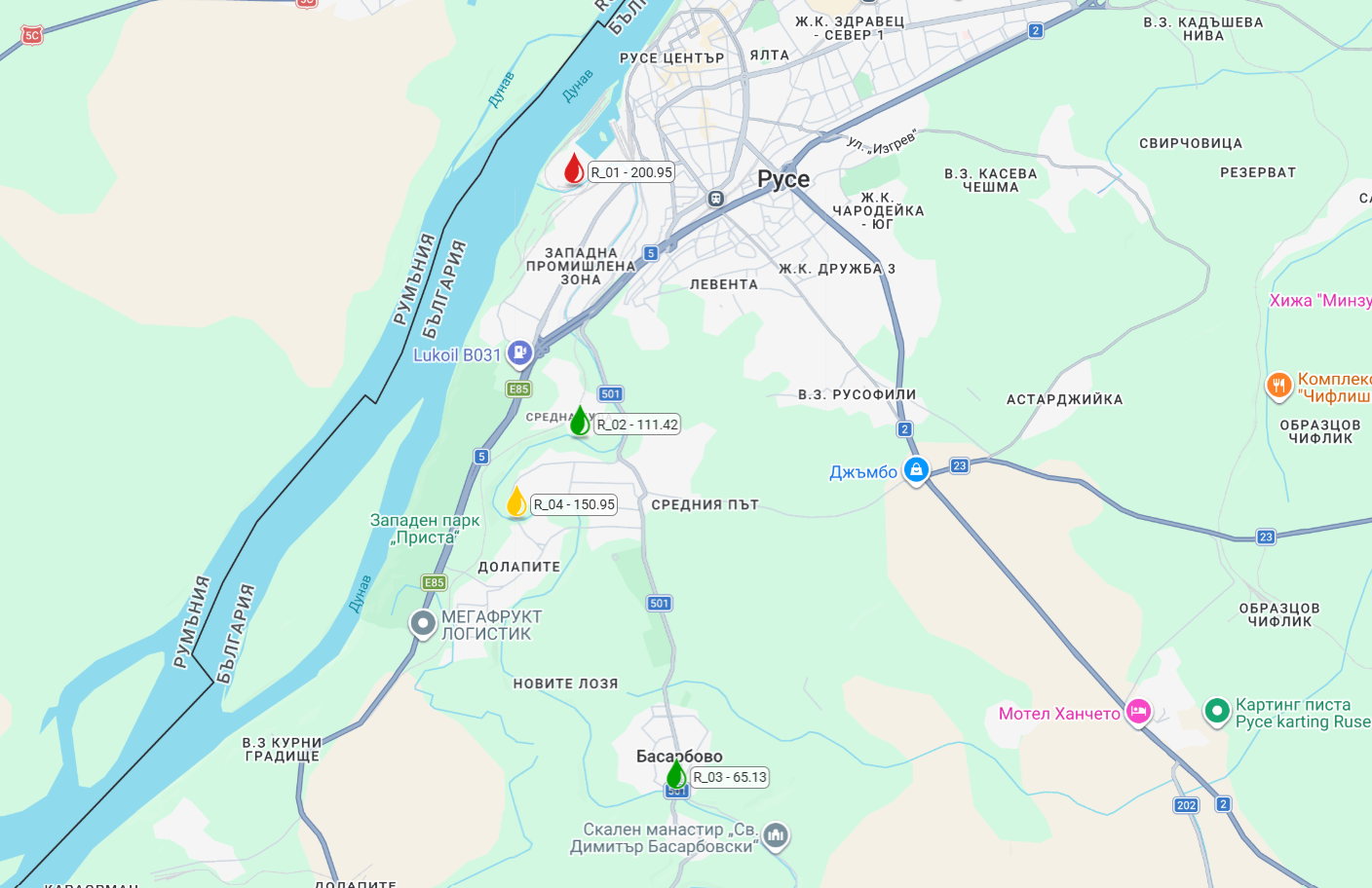
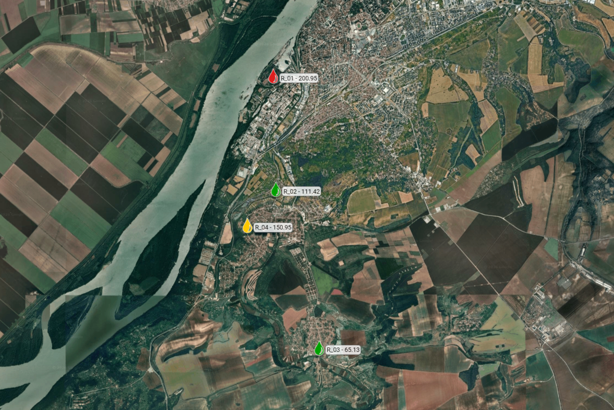
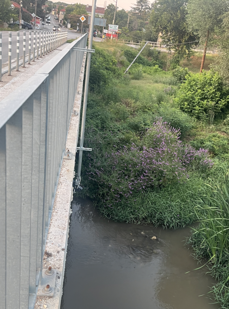
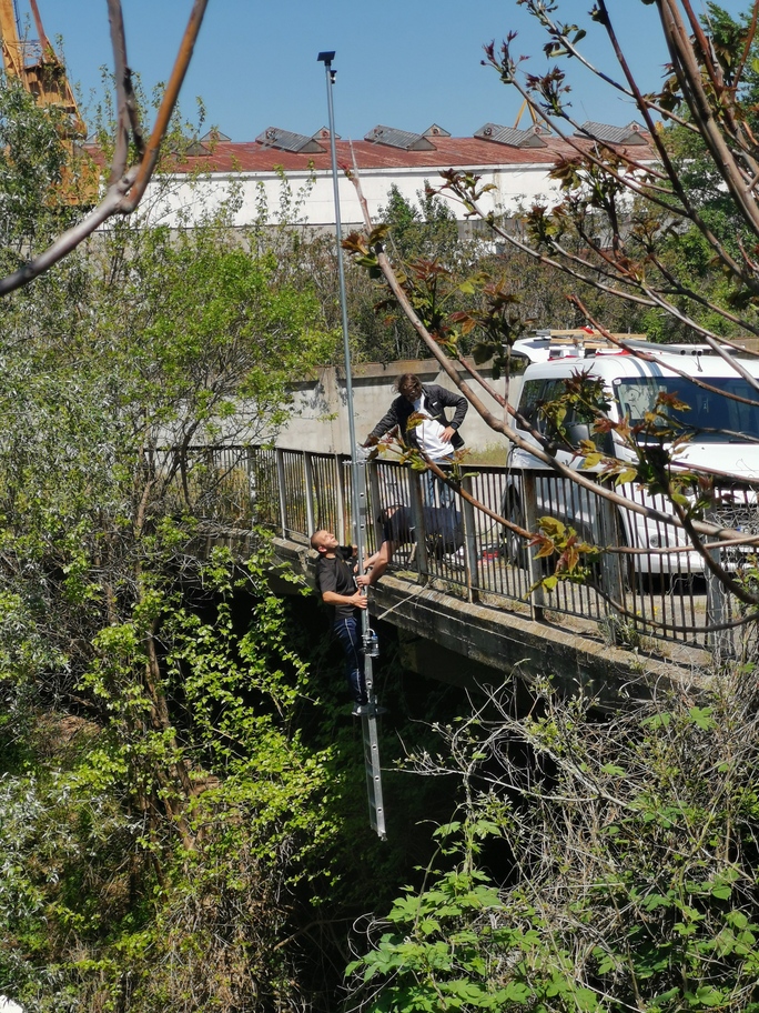
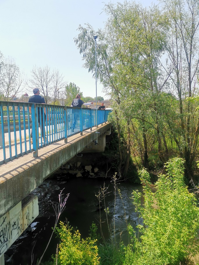
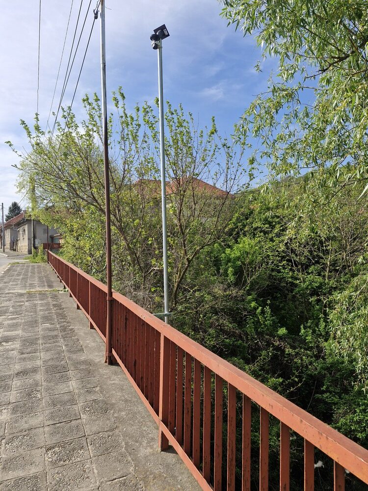
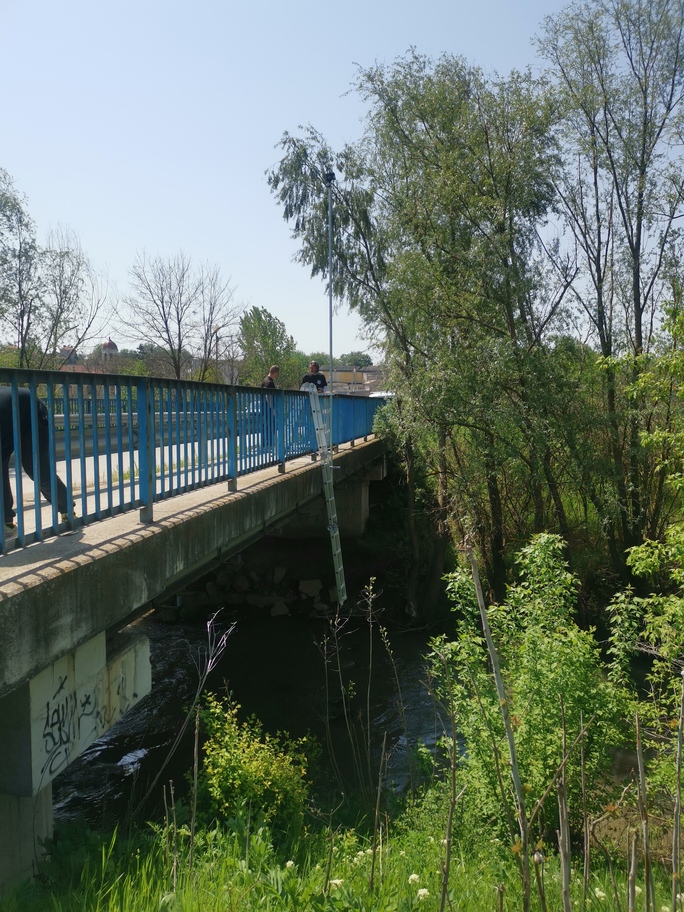
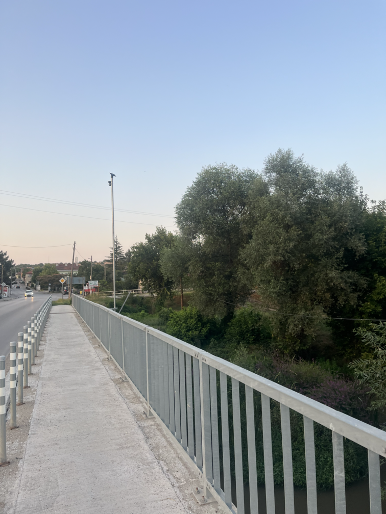
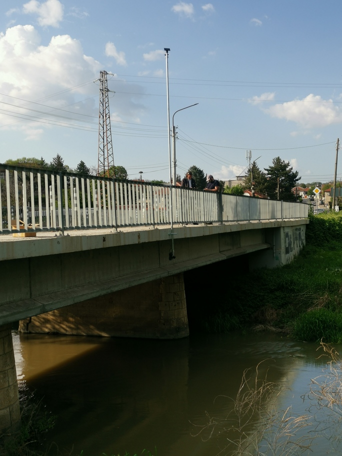
- Where: Stations located on four key bridges along the Rusenski Lom River within the municipality.
- How it works: Radar sensors with millimeter precision measure the distance to the water surface.
- Prevention: The system features three warning levels. Upon crossing critical thresholds, it automatically sends SMS alerts to responsible institutions (Fire Safety and Civil Protection, Municipality, etc.), allowing for a lightning-fast response.
NB: These sites are not just tourist destinations but part of Ruse’s “living laboratory.” Through NBSINFRA, we are not just installing sensors; we are building a bridge between history and future security technologies.
The Role of Ruse Municipality in the NBSINFRA Project: A Path to Climate Resilience
Why Nature-based Solutions (NBS) are a Priority for Ruse
For the Municipality of Ruse, integrating nature-based solutions is not merely an ecological trend, but a strategic necessity. Traditional “grey” infrastructure (concrete dams and drainage canals) is no longer sufficient to keep pace with a changing climate.
NBS are vital because of their:
- Multifunctionality: A riparian zone restored through NBS simultaneously protects against floods, purifies water, and serves as a recreational space for citizens.
- Economic Efficiency: Natural ecosystems possess self-healing capabilities and require lower long-term maintenance costs compared to concrete structures.
- Biodiversity Conservation: The Rusenski Lom river basin is a unique ecological corridor; its preservation is directly linked to the quality of life for all Ruse residents.
Climate Threats: Challenges We Face
Ruse’s geographical location places it at high risk from several key climatic factors:
- Hydrological Risk: The Rusenski Lom River is prone to “flash floods”—sudden and powerful surges that threaten both infrastructure and cultural heritage, such as the Basarbovo Monastery.
- Urban Heat Islands: As a major industrial center, Ruse suffers from extreme summer temperatures. A lack of sufficient “green lungs” within the urban fabric amplifies the negative impact on public health.
- Erosion and Landslides: Intense rainfall followed by drought periods compromises the stability of riverbanks and loess soils, posing risks to buildings and roads.
Strategic Framework: Plans and Policies
Ruse Municipality operates within a clear legal and strategic framework. Participation in NBSINFRA is directly linked to the implementation of:
- Integrated Development Plan (IDP) 2021-2027: Outlines the core goals for sustainable urban development and infrastructure modernization.
- Climate Change Adaptation Strategy: A document identifying critical regional risks and prescribing preventive measures against disasters.
- Flood Risk Management Plan (FRMP): Ruse works in synchronization with the Danube Region Basin Directorate to ensure technological solutions (like ACWA sensors) complement national safety measures.
The Community as a Partner: How Citizens Participate in NBSINFRA
Ruse Municipality believes that city resilience depends not only on sensors and strategies but on the awareness and actions of every resident. In our “City Lab,” citizens are not just observers—they are co-authors of safety.
Citizen Science and Monitoring (1)
Any resident living near the Rusenski Lom basin or visiting protected areas can contribute by:
- Real-time Reporting: Notifying authorities of unusual overflows, bank erosion, or debris accumulation that could block the riverbed.
- Visual Documentation: Sending photos of critical points during heavy rains, helping experts calibrate hydrological models.
Co-creation Process (2)
Through public consultations and workshops, the Municipality involves citizens in choosing locations for NBS implementation:
- Urban Environment Dialogue: Identifying where more “green buffers” are needed for shade and rainwater absorption.
- Heritage Protection: The community helps identify lesser-known local cultural and natural sites that require specific nature-based protection.
Early Warning and Personal Safety (3)
Citizens have direct access to project data:
- Data Transparency: Through the ACWA platform, any Ruse resident can monitor river levels in real-time.
Education and Volunteering (4)
Municipality or Ruse gives the opportunity to include initiatives for schools and volunteer organizations:
- Green Patrols: Educational walks in the canyon explaining how natural vegetation protects us from disasters.
- Volunteer Campaigns: Cleaning and restoring riverbanks, which is the simplest yet most effective form of a nature-based solution.
Digital Innovations and Monitoring Methodologies
In alignment with the NBSINFRA project goals, the Agency for Sustainable Development and European Integration (ASDE-ECOREGIONS), in partnership with the Municipality of Ruse, has developed a suite of innovative applications. These tools are currently being deployed within the leading pilot area – the Rusenski Lom river basin – with plans for future expansion across the entire municipality.
Key components of our technological framework include:
- Green Infrastructure Indicator Monitoring: A specialized methodology to track trends in green space percentages within urban zones, in accordance with the General Development Plan of Ruse. This work aligns with the latest requirements of Regulation (EU) 2025/912. More information can be found here
- Land Subsidence & Landslide Tracking: Advanced monitoring of ground displacement and potential landslide activity to protect urban assets and public safety. More information can be found here
- Exposure and Loss Dataset (ELD): The creation of a comprehensive municipal database for vulnerability and damage assessment, enabling simplified risk profiling for local administrative units. More information can be found here
- Flood Simulation & Infrastructure Impact Models: Continuous update and maintenance of simulation models for flood probability along the Rusenski Lom River, specifically focusing on potential damage to critical infrastructure. More information can be found here
- Copernicus-Based Land Cover Monitoring: A methodology for monitoring land cover changes by integrating data from the European Copernicus Programme with on-site observations, fully compliant with the global ISO 19144 standard.

Funded by
the European Union