
Fingal
Ireland
Swords, a suburban town north of Dublin, serves as the administrative capital of Fingal County. It is positioned strategically with direct links to the national road network, and close to Dublin Port and the airport.
The city lab examines the impacts of climate change-induced extreme weather and flooding, with a particular emphasis on the surrounding green infrastructure and river valley systems. Various scales are applied to evaluate nature-based solutions (NBS) interventions. A priority is the implementation of NBS for water-sensitive design, particularly in the context of safeguarding critical infrastructure.

Maps

As part of the NBSINFRA project, Swords has been selected as a study area where nature-based solutions are integrated into the Local Area Plan, particularly to protect critical infrastructure. This project focuses on the impacts of extreme weather and flooding, with a particular emphasis on enhancing green infrastructure.
Swords, a thriving suburban town, faces various hazards related to extreme weather, ageing infrastructure, and strain from population growth. There is a distinctive opportunity to integrate NBS into the town’s future development plans. The council aims to establish a green necklace of open spaces encircling the town, including new parks and woodlands, not only to prevent urban sprawl and promote compact growth but also to enhance the area’s climate resilience by creating natural buffers against extreme weather events and fostering biodiversity.
What is the role of Fingal County Council?
Fingal County and Ireland as a whole are increasingly vulnerable to the effects of climate change. Fingal’s coastal location, combined with a growing population, heightens its susceptibility to rising sea levels and extreme weather events. Projections suggest that previous climate trends will become more severe, with rising temperatures throughout the year, reduced precipitation in spring and summer, and more frequent intense rainfall and wind conditions. Rising sea levels are expected to have significant impacts on coastlines and coastal communities, while river flooding, soil erosion, and hotter summers will present additional challenges. Fingal County Council is committed to addressing these concerns through adaptation and mitigation efforts.
In the recent period, the Council adopted the Fingal Development Plan and Fingal Climate Action Plan, which outline various activities to enhance the climate resilience of our settlements. The Council recognises the crucial role of citizen engagement in developing Local Area Plans that concretely implement both Development and Climate Action plans’ visions and goals.
Fingal County Council's Development Plan 2023-2029
The Fingal County Council Development Plan outlines a vision for a sustainable and resilient future for the county. Key priorities include promoting climate action, creating healthy communities, and protecting natural heritage. NBS play a crucial role in achieving these goals by providing nature-based solutions to address climate challenges. It draws on the historical heritage of Fingal and uses skills and expertise to continue sustainable social, environmental, and economic growth well into the future, with a focus on creating vibrant and resilient communities. This Plan sets out the spatial framework to guide future development within the County with a focus on the places of living, work, tourism and business, and how to interact with these places while protecting the environment.
The objectives of the development plan are:
- Transition to an environmentally sustainable, carbon-neutral economy while enhancing renewable energy, water, and transportation infrastructure.
- Develop high-quality residential and urban spaces, ensuring sustainable and well-connected neighbourhoods.
- Protect and enhance Fingal’s unique character, built and cultural heritage, and natural biodiversity.
- Regenerate town centres by repurposing unused lands and buildings for residential and mixed-use development.
- Prioritise sustainable transport modes, including walking, cycling, and public transport, while reducing car dependency.
- Facilitate climate change adaptation and flood risk measures through green infrastructure and open space initiatives.
The Local Area Plan (LAP)
The Fingal County is continuing to develop and implement LAPS currently in place and proposals of 5 new LAPs are to be prepared during the plan period. This includes: Swords, Flemington , Coolquay, Balscadden and Ballymadun. These will be prepared in co-operation with relevant stakeholders and actively secure the implementation of these plans and the achievement of the specific objectives indicated.
These areas present substantial land banks with significant redevelopment and regeneration potential, requiring a long lead time to develop a workable framework for delivery as well as significant social and physical infrastructure requirements.
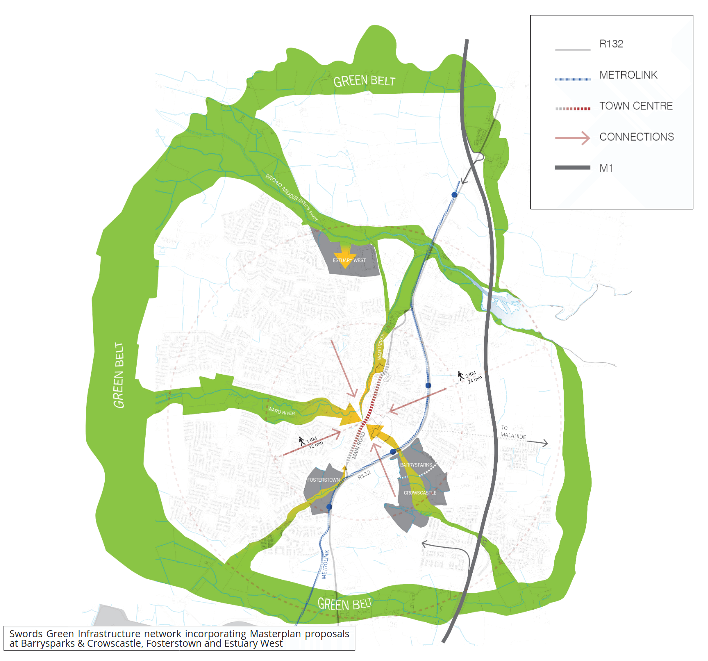
At Swords, FCC’s strategy focuses on harnessing Nature-based solutions (NBS) to enhance urban resilience. Through this, some expected outcomes are:
- Integration of NBS into urban drainage and flood management
- Assessment of road and railway infrastructure resilience
- Assessment of eco-resilience in the River and estuary area
- Building community capacity for water retention and climate resilience
- Capacity building within the local authority for NBS implementation.
Co-creation process
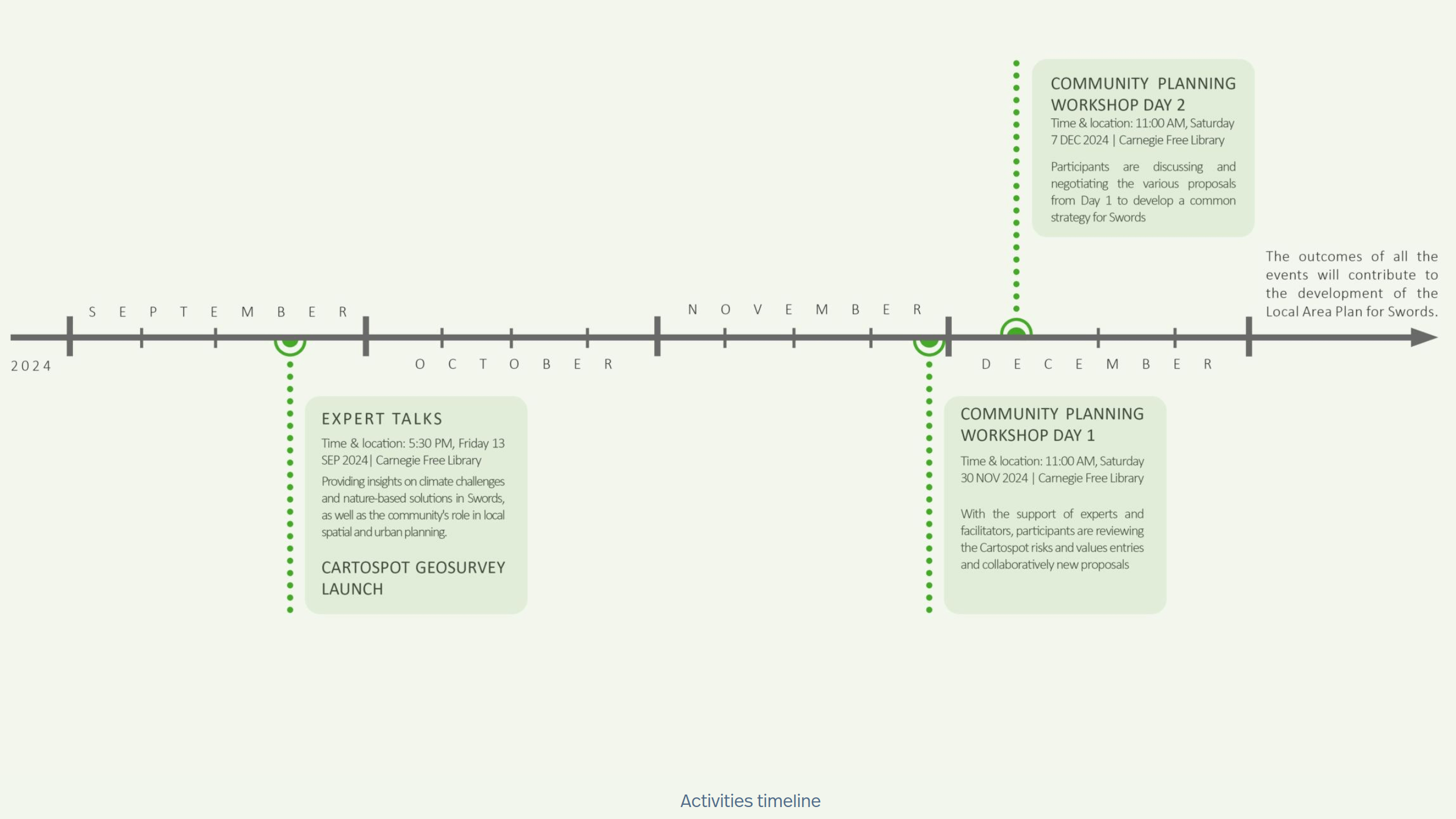
In the later stages of the NBSinfra project, we proceeded with various activities to raise awareness, exchange knowledge, and co-create specific proposals aimed at informing the process of developing the Swords Local Area Plan, and also to enhance co-creation opportunities with the local communities.
In this process, we aimed to identify all potential stakeholders who can contribute to co-creation process and in order to determinate the most suitable planning solutions for Swords.
Swords Risks and Values Survey
The initial activity of co-creation process involved mapping the community insight regarding Swords RISKS and VALUES.
Using the Cartospot tool, and following several days of fieldwork to promote the activity and engage with the community, over 50 diverse entries were mapped at various locations, including Swords Library, community centers, and Fingal County Council. These insights were then categorized into three main themes:
- Environment (climate challenges, biodiversity, nature-base solutions, etc.)
- Urban Mobility (traffic challenges, public transport, cycling, walking, etc.)
- Urban Planning (housing, amenities, compact vs sprawl development, etc.)
Cartospot results
The results were then systematised on the map to provide a clear overview of the categorised entries used in the co-creation workshop.
Co-creation Workshop
A co-creation workshop took place over two Saturdays, 30th November and 7th December, to discuss the risks and values identified by the broader community and develop specific solutions to inform the drafting of the Swords Local Area Plan.
The results from two-day workshop sessions, help us to delve deeper into the community’s input. Guided by facilitators and experts, the workshop aimed to generate specific proposals that can contribute and to be considered in the process of new Local Area Plan for Swords drafting.
Day 1 (30th November):
The community-identified inputs were categorized into three themes:
- Environment (climate challenges, biodiversity, nature-based solutions, etc.);
- Urban Mobility (traffic issues, public transport, cycling, walking, etc.);
- Urban Planning (housing, amenities, compact versus sprawl development, etc.).
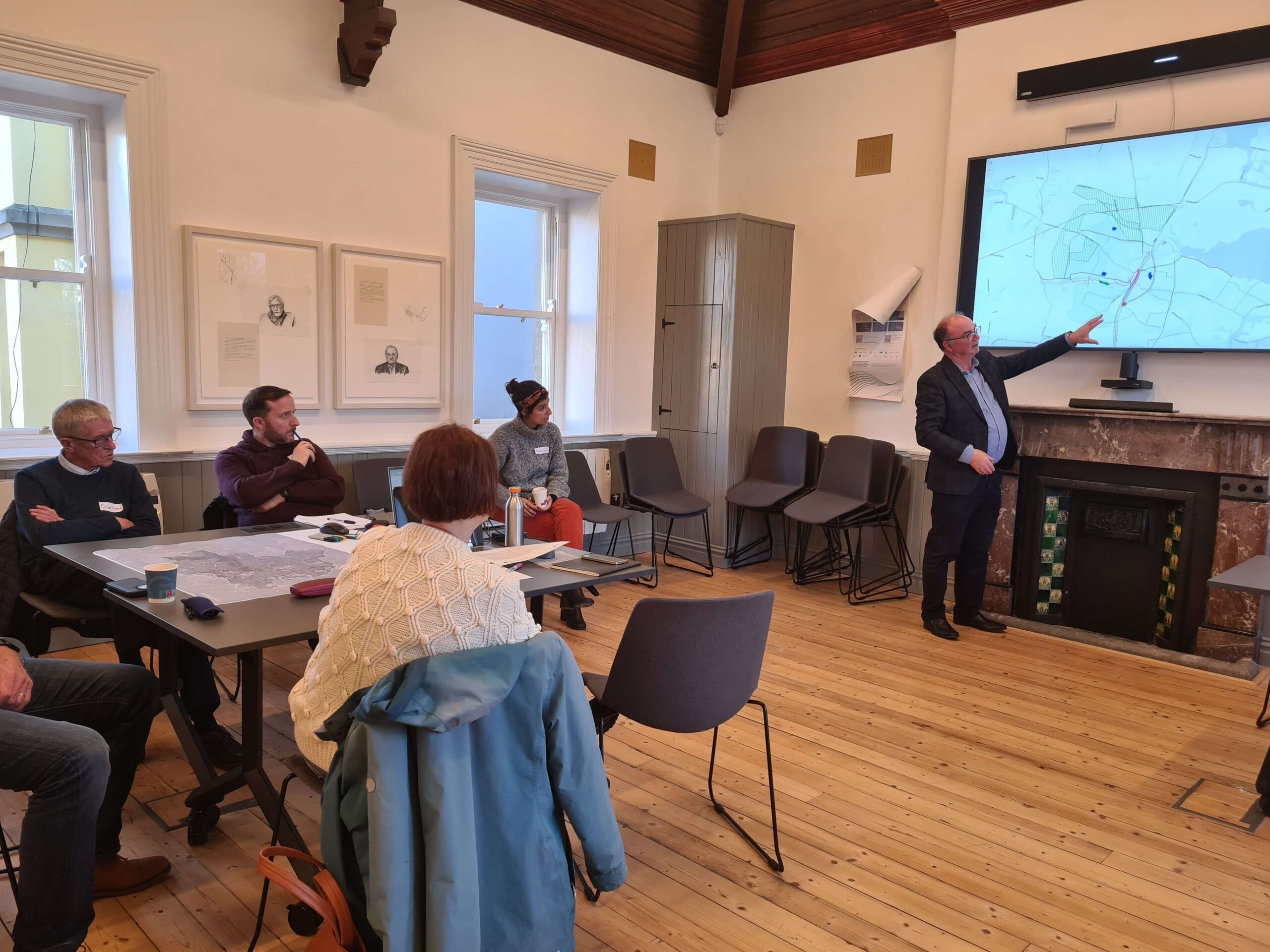
- These categories guided the group sessions of the first day. Participants, supported by facilitators and experts, worked in groups to reflect on the community’s ideas and propose specific planning solutions.
Integration of the solutions
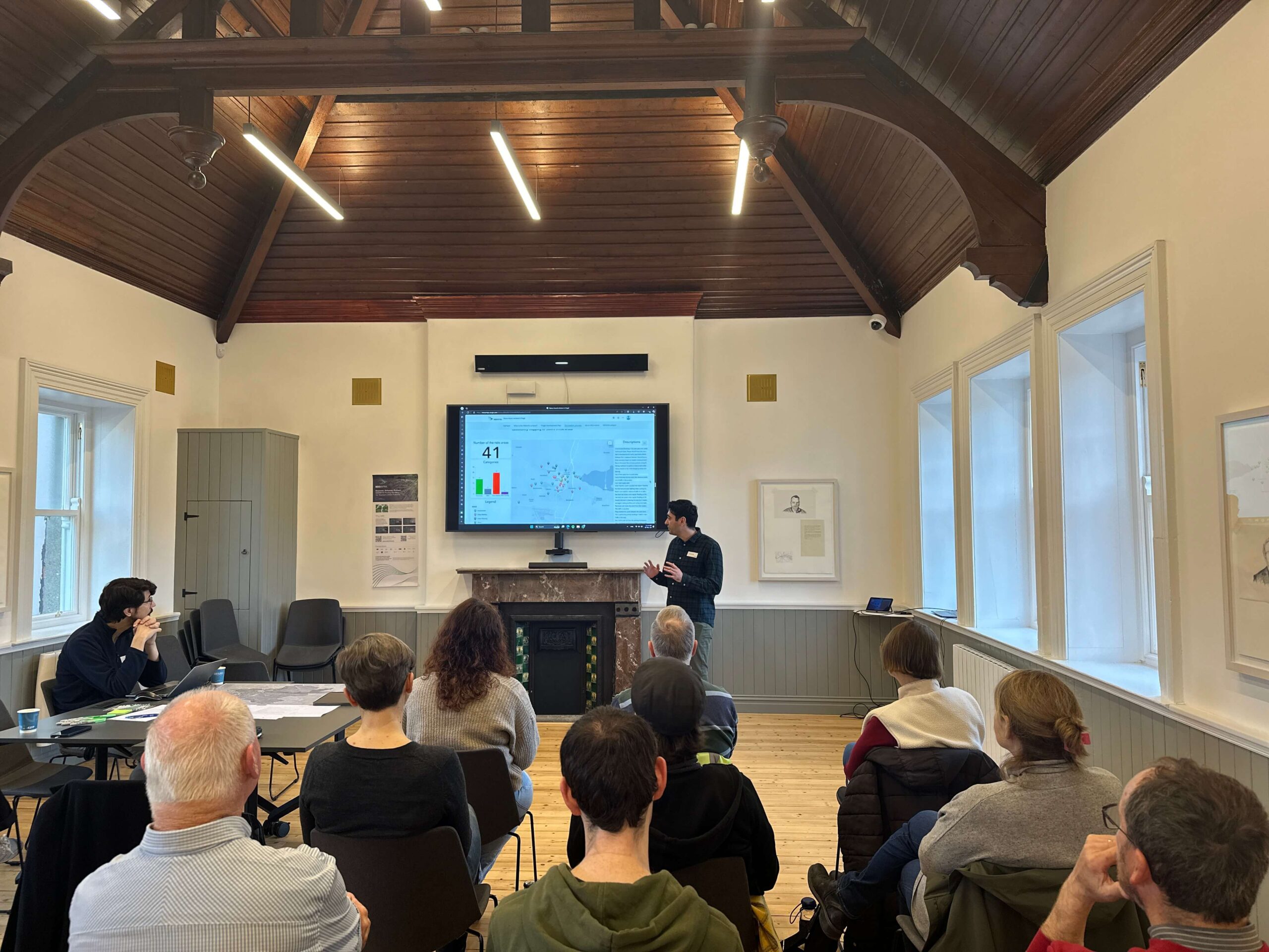
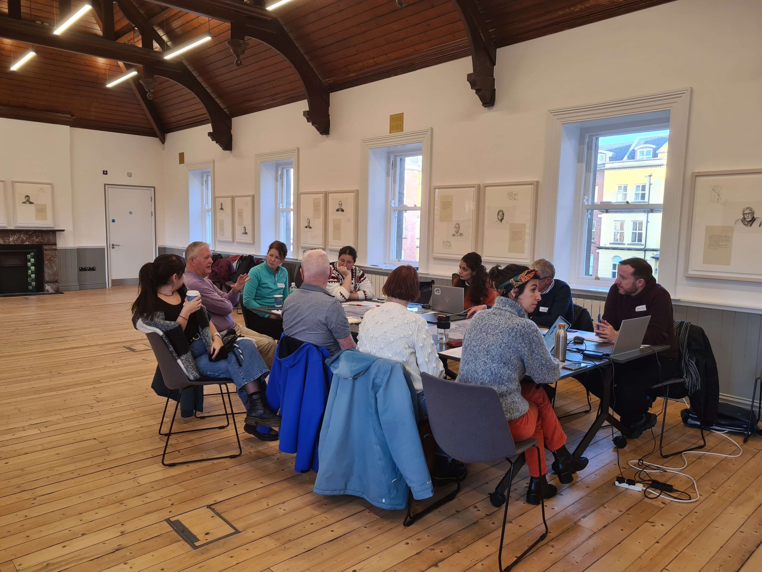
Day 2 (7th December):
The second day of the workshop was built on ideas generated during the day one sessions. The various ideas that emerged during the Day 1 workshop were categorized into the following systems:
- Transport (TRN)
- Active Transport (ATRN)
- Heritage (HRTG)
- Nature-Based Solutions (NBS)
- Amenities (AMN)
- Miscellaneous (MISC)
During the Day 2 workshop, participants, split into two groups, were tasked with selecting planning solutions from a wide range of proposals. Through discussion and negotiation, each group developed its own proposal, covering area of Swords and its surroundings. In the final stage, the groups merged to agree on a unified proposal. The sessions were facilitated using Geodesignhub, a digital tool designed to support negotiation and collaborative decision-making.
Proposed strategies by two groups
The map below displays the strategies developed during the group session, which involved two teams. Each team selected the most suitable solutions for their group, and the outcomes are shown on the map. To explore the different strategies, click on “Team A” or “Team B” in the map legend.
Two groups' strategies
Negotiated strategy
Based on the outcomes of the two group sessions, the groups joined together to discuss and negotiate a common strategy, addressing agreements and disagreements with the support of the Geodesignhub tool.
Negotiated strategy
The results in the next stage will be presented to Fingal County Council to support the development of the Local Area Plan. This will provide a clear and actionable overview of the workshop findings in order to help to integrate community input, with the goal to ensure the inclusiveness of this important urban plan document.

Funded by
the European Union