
Cologne
Germany
Cologne is the largest city in North Rhine-Westphalia, Germany, with a long history of Rhine floods for which nature-based solutions have been implemented to work together with the grey infrastructure. Additionally, climate change is increasing the likelihood of hazards such as flash floods and heat waves. For these emerging risks, NBS are also being tested and planned as they can contribute to mitigation while providing a range of co-benefits.
The Cologne City Lab investigates NBS at different stages of implementation to address river floods, flash floods, and heat islands in the city and surroundings areas.
Sections

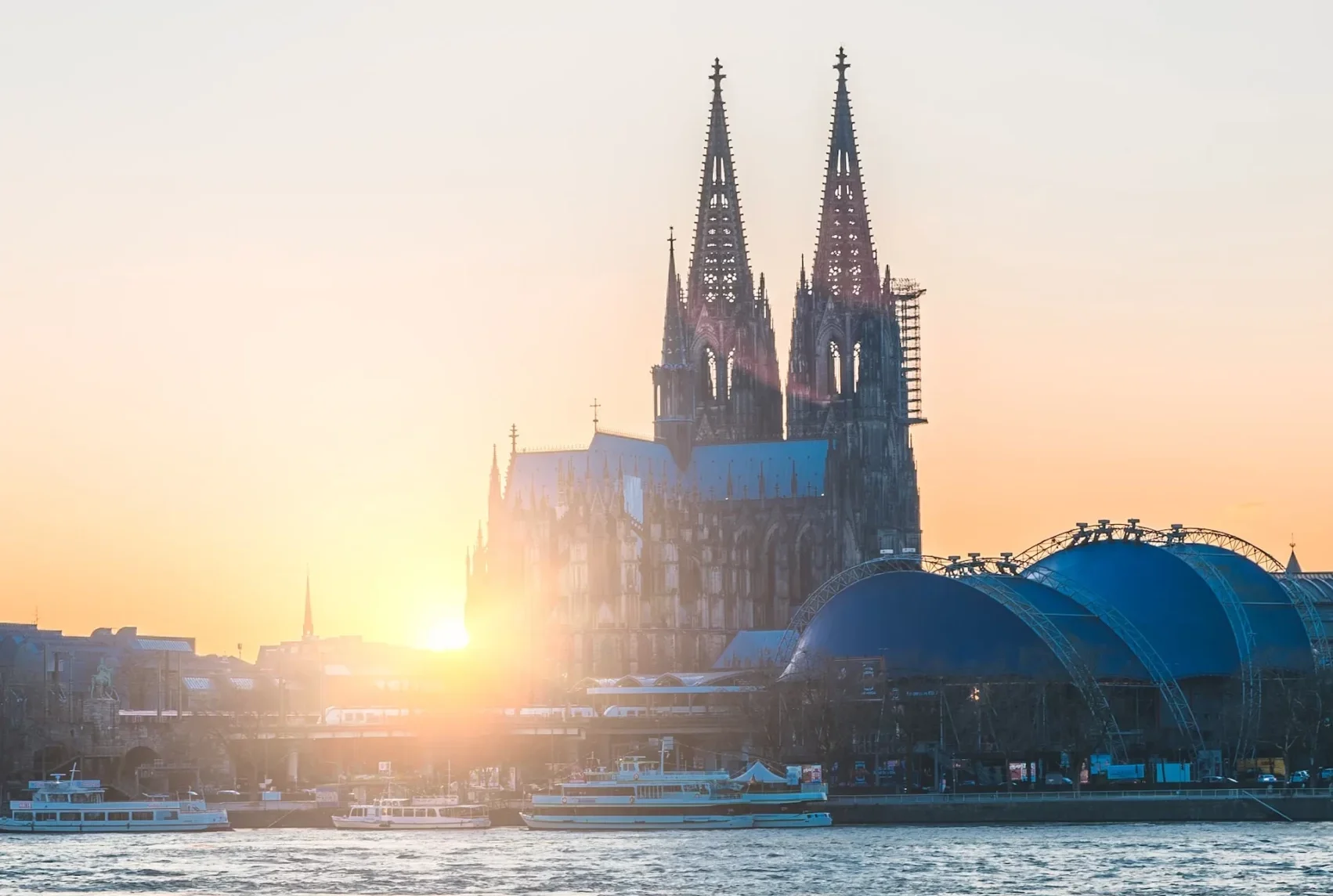
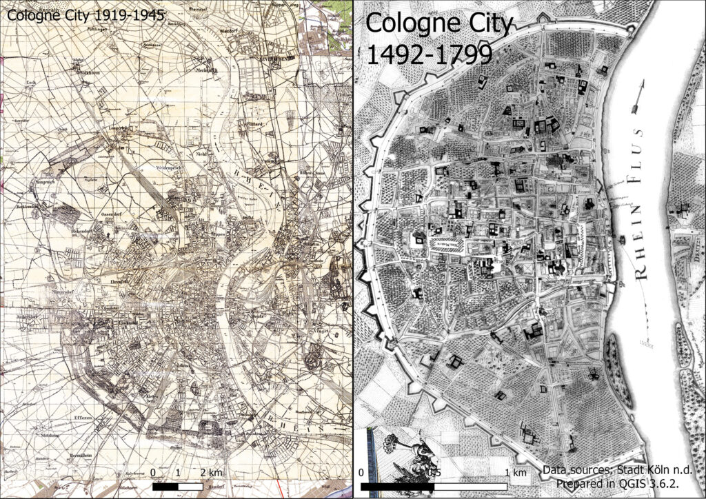
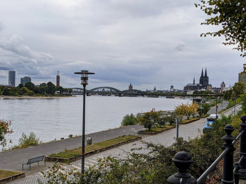
The city of Cologne, founded in AD50 by the Romans, is a modern city in West Germany with a population of 1.1 million people. The Rhine River flows through the centre of the city and is the focal point of the city.
The Cologne City Lab
Includes Cologne City, Leverkusen and Rheinisch Bergisher Kreis to the east and Rhein Erft Kreis to the west. The map and images below show the location of the city lab and examples of the city and natural landscapes.
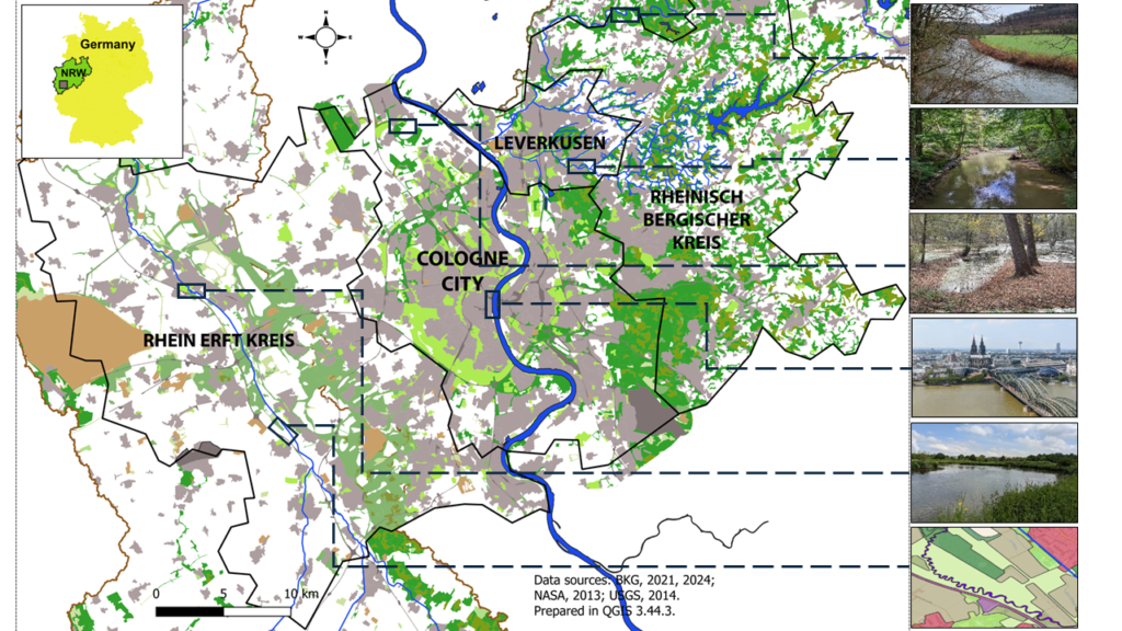
Leverkusen, an industrial city, is located where the Wupper River empties into the Rhine. Rheinisch Bergischer Kreis with undulating landscape gives rise to many smaller tributaries to the Wupper. Rhein Erft Kreis to the west is predominantly farmland with small cities located along the River Erft, another Rhine tributary.
There are multiple hazards affecting the Cologne District as illustrated in the map below. They include the ever-present hazards such as Rhine River floods and hazards enhanced by climate change. Increased atmospheric heat and water holding capacity enhance hazards such as pluvial and fast moving fluvial floods in the Wupper and Erft basins, and urban heat island impacts in Cologne City.

Aims
The Cologne City Lab represents the 4th stage for the NBSINFRA project and as such the main task is to identify, evaluate and monitor NBS.
Methods: We combine the analysis of existing spatial data with the creation of new layers to document, illustrate and assess NBS. We source observed and modelled data and use tools that are available for NBS design. We work with NBSINFRA partners to identify factors of resilience and sustainability through simulation and the impact of hazards on critical infrastructure. Workshops were organised to facilitate knowledge transfer and dissemination.
Rhine floods in Cologne city
Human lives, homes and critical services such as hospitals, roads, electricity supply and fire stations are all affected by hazards in the Cologne District.
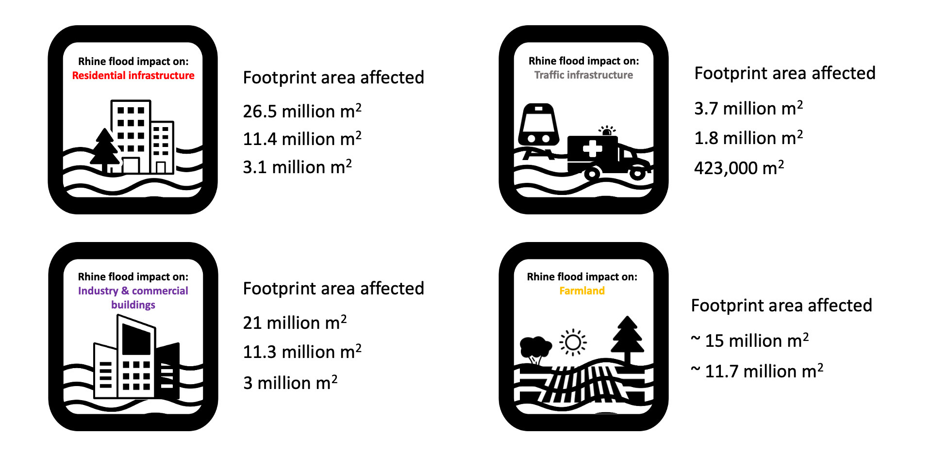
Rhine floods in Cologne city: The figures below show the footprint area of infrastructure, residential, industry, traffic and agricultural land, which will be covered with water by 10-50, 100 and >250-year statistical return period floods.
The map below shows the infrastructure that would be affected if an extreme flood (HQ >250) occurs. This flood could affect the operation of up to 40 transformer stations, 6 hospitals, 7 fire stations and 16 nursing and group homes.

Rhine floods in 1993 and 1995 caused 70 € million and 35 € million worth of damage respectively. As a result, StEB (Cologne’s municipal drainage managers) introduced the Flood Protection Concept to protect the city.
In Cologne city a mix of engineered and nature based flood protection are employed to mitigate the risk of flooding to this critical infrastructure.
Engineered (grey) infrastructure includes mobile walls which are employed in the old town of Cologne, levees which extend along the river throughout the city and pumping stations which prevent groundwater floods in the city. The map below shows grey infrastructure and NBS in Cologne City for Rhine floods.
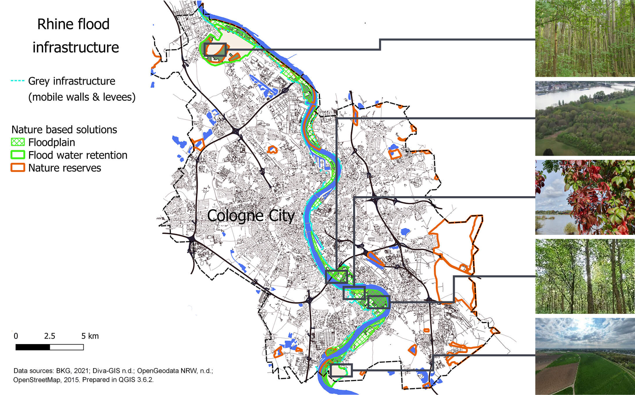
Nature based solutions include retention basins and retained floodplain. Retained floodplains line the Rhine within the city and allow minor floods to spill overbank without disrupting everyday city life. They are natural to semi-natural areas, which include nature reserves, and areas for recreation. Retention basins mimic the function of more extensive natural floodplains by reducing the flood peak for the local area and downstream. Cologne has one flood retention basin in the south and another planned in the north. The majority of Cologne City is protected by these measures against floods up to a 200-year statistical return period.

Funded by
the European Union